


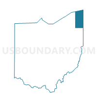
Monroe 2 Voting District, Ashtabula County, Ohio
About
Outline

Summary
| Unique Area Identifier | 642735 |
| Name | Monroe 2 Voting District |
| County | Ashtabula County |
| State | Ohio |
| Area (square miles) | 19.05 |
| Land Area (square miles) | 19.03 |
| Water Area (square miles) | 0.02 |
| % of Land Area | 99.87 |
| % of Water Area | 0.13 |
| Latitude of the Internal Point | 41.84159000 |
| Longtitude of the Internal Point | -80.54989710 |
Maps


Graphs
Select a template below for downloading or customizing gragh for Monroe 2 Voting District, Ashtabula County, Ohio


Neighbors
Neighoring Voting District (by Name) Neighboring Voting District on the Map
- BEAVER TWP Voting District, Crawford County, PA
- Conn 1-B Voting District, Ashtabula County, OH
- Conn 2-D Voting District, Ashtabula County, OH
- CONNEAUT TWP Voting District, Erie County, PA
- Monroe 1 Voting District, Ashtabula County, OH
- Pierpont Voting District, Ashtabula County, OH
Top 10 Neighboring County Subdivision (by Population) Neighboring County Subdivision on the Map
- Conneaut city, Ashtabula County, OH (12,841)
- Conneaut township, Erie County, PA (4,290)
- Monroe township, Ashtabula County, OH (2,381)
- Pierpont township, Ashtabula County, OH (1,285)
- Beaver township, Crawford County, PA (902)
Top 10 Neighboring Place (by Population) Neighboring Place on the Map
Top 10 Neighboring Unified School District (by Population) Neighboring Unified School District on the Map
- Conneaut School District, PA (18,617)
- Conneaut Area City School District, OH (14,670)
- Buckeye Local School District, OH (12,625)
- Northwestern School District, PA (12,097)
Top 10 Neighboring State Legislative District Lower Chamber (by Population) Neighboring State Legislative District Lower Chamber on the Map
Top 10 Neighboring State Legislative District Upper Chamber (by Population) Neighboring State Legislative District Upper Chamber on the Map
- State Senate District 32, OH (311,809)
- State Senate District 49, PA (241,903)
- State Senate District 50, PA (235,966)
Top 10 Neighboring 111th Congressional District (by Population) Neighboring 111th Congressional District on the Map
Top 10 Neighboring Census Tract (by Population) Neighboring Census Tract on the Map
- Census Tract 12, Ashtabula County, OH (7,482)
- Census Tract 1103, Crawford County, PA (4,920)
- Census Tract 101.03, Erie County, PA (2,079)